원자력공학과, ‘원자력 안전규제라운드테이블’ 개최

연구 2026년 09월 30일 수요일

겨울 한파·폭설 예측 성패, ‘중앙태평양 엘니뇨’에 있었다!

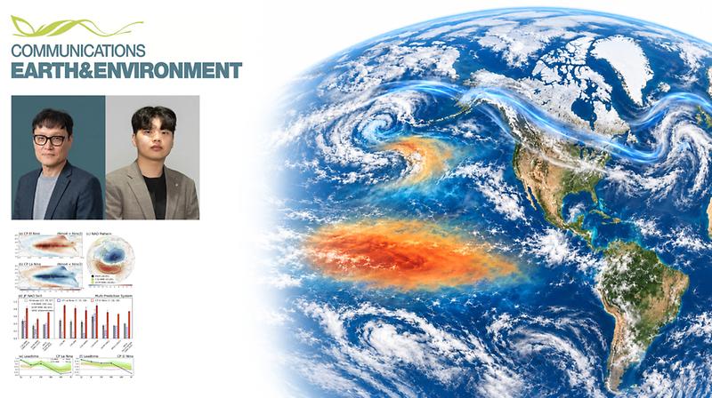
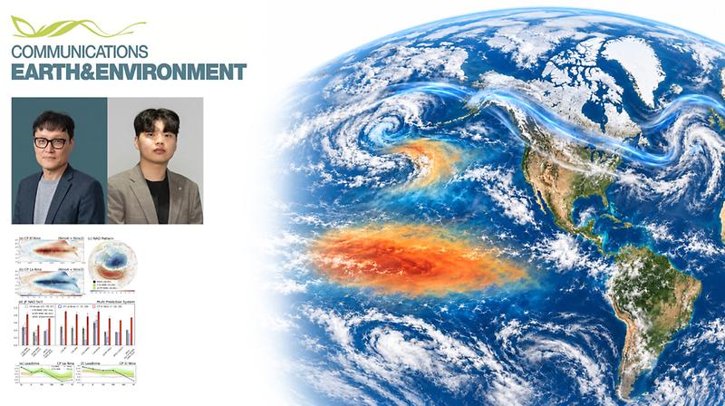
중앙태평양 엘니뇨가 발생한 해의 겨울에는 북반구 겨울 기후의 예측 정확도가 높아질 수 있다는 연구 결과가 나왔다. 지구환경도시건설공학과 이명인 교수 연구팀은 한국과학기술연구원(KIST), 영국 기상청 해들리센터와의 공동 연구를 통해 중태평양에서 발달하는 엘니뇨가 겨울철 북대서양진동(NAO)의 예측 정확도를 크게 높이는 현상과 원인을 규명했다. 북대서양진동(North Atlantic Oscillation, NAO)은 북극의 찬 공기를 가두는 제트기류의 강도를 좌우하는 대기 순환 패턴이다. 북반구 한파와 폭설에 큰 영향을 미치지만 해마다 변동 폭이 커 한 달 뒤 상황조차 예측하기 어렵다. 연구에 따르면, 중앙태평양 엘니뇨가 발생한 겨울에는 북대서양진동을 훨씬 더 잘 예측할 수 있었다. 여러 계절 예측 시스템이 11~12월에 내놓은 이듬해 1~2월의 NAO 예측값을 실제 관측과 비교한 결과, 전체 분석 기간의 예측 상관계수는 0.48이었지만 중앙태평양 엘니뇨가 발생한 겨울에는 0.78까지 높아졌다. 이 수치가 1에 가까울수록 해마다 달라지는 NAO의 변화를 잘 예측했다는 뜻이다. 연구진은 이러한 차이가 중앙태평양 엘니뇨가 북태평양 수온과 북대서양 대기 사이의 연결을 강화하기 때문인 것으로 분석했다. 중앙태평양 엘니뇨가 발생하면 알래스카와 하와이 사이 알류샨 열도 남쪽 바다, 즉 북태평양의 수온 변동이 커지면서 저기압이 주로 발달하고 이동하는 경로인 ‘스톰트랙’의 위치와 세기도 바뀐다. 이 스톰트랙 변화가 제트기류의 변화와 맞물려 북미를 거쳐 북대서양까지 이어진다는 것이다. 북태평양 수온은 대기보다 천천히 변해 비교적 오래 유지되기 때문에, 북태평양 수온과 북대서양 대기의 연결이 강해질수록 이후 NAO 변동을 미리 가늠할 수 있는 단서도 강하게 나타나게 된다. 제1저자인 김기욱 연구원은 “북대서양은 대기의 자연 변동성이 매우 강해 기후 모델이 예측 가능한 신호를 충분히 포착하기 어려운 지역인데 중태평양 엘니뇨가 발생할 때 강화되는 원격상관으로 NAO를 예측할 수 있는 ‘기회의 창’이 열리는 셈”이라고 설명했다. 원격상관은 멀리 떨어진 두 지역의 기후 현상이 대기나 해양의 흐름을 통해 서로 연결돼 함께 변하는 현상이다. 기후 모델이 이러한 예측 단서를 충분히 반영하지 못하고 있다는 점도 확인됐다. 중앙태평양 엘니뇨가 발생한 겨울에는 실제 관측과 비교한 NAO 예측 성능이 크게 높아졌지만, 여러 차례 기후 모델을 돌린 결과에서 계산한 예측 가능한 신호의 크기는 그만큼 증가하지 않은 것이다. 실제 대기가 기후 모델 내부에서 나타나는 것보다 더 잘 예측되는 이러한 현상을 ‘신호 대 잡음 역설’이라고 한다. 연구진은 북태평양 수온과 북대서양 대기 사이의 연결을 기후 모델이 실제보다 약하게 표현하는 것이 신호 대 잡음 역설의 한 원인일 수 있다고 분석했다. 이명인 교수는 “엘니뇨의 발생 위치와 위상에 따라 달라지는 원격상관을 기후 모델에 정확하게 반영하는 것이 겨울철 예측 성능을 높이는 데 중요하다”며 “이번에 규명한 북태평양과 북대서양 사이의 원격상관 과정을 기후 모델이 보다 잘 재현한다면 북대서양진동뿐 아니라 한파와 폭설 등 겨울철 이상기후의 장기 전망을 개선하는 데도 도움이 될 것”이라고 설명했다. 이번 연구 결과는 세계적 권위지 네이처(Nature)의 지구·환경과학 분야 자매지인 ‘커뮤니케이션스 어스 앤드 인바이런먼트(Communications Earth & Environment)’에 8월 27일 공개됐다. 연구 수행은 기상청의 ‘기후위기 대응 국가기후예측시스템 개발’ 사업과 과학기술정보통신부의 한국연구재단(NRF) 사업(RS-2026-25492386)의 지원을 받아 이뤄졌다.

원자력공학과, ‘원자력 안전규제라운드테이블’ 개최

연구 2026년 09월 22일 화요일

“위성영상 속 단풍·낙엽에 안 속는다”.. 계절 보정 산불 피해 분석 기술 개발

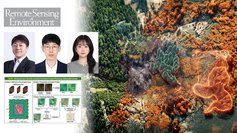
산불 피해 정도를 파악할 때는 현장을 일일이 조사하기 어려워 주로 산불 전후에 촬영된 인공위성 영상을 활용한다. 하지만 촬영 계절이 다르면 계절에 따른 초목의 변화까지 산불 피해로 잘못 판단할 수 있는데, 국내 연구진이 이 계절 변화의 영향을 보정해 서로 다른 시기에 촬영된 위성사진으로도 산불 피해 정도를 정확하게 분석할 수 있는 기술을 내놨다. UNIST 지구환경도시건설공학과 임정호 교수팀은 인공위성 영상에서 계절에 따른 식생 변화 영향을 걸러내고, 산불로 인한 변화 신호를 보다 정확하게 추출하는 새로운 산불 피해 강도 분석 기법인 ASAP(Advanced burn Severity Analysis with Phenology-detrended indices)을 개발했다고 1일 밝혔다. 산불 피해 강도는 산불로 인해 숲과 초지가 얼마나 크게 변했는지를 보여주는 지표다. 피해가 심한 지역을 가려내 복구 우선순위를 정하고 산불 이후 산림 관리 계획을 세우려면 이를 빠르고 정확하게 파악하는 것이 중요하다. 인공위성 영상을 이용한 산불 피해 강도 분석법은 넓은 피해 지역을 한꺼번에 살펴볼 수 있지만, 분석에 적합한 영상을 구하기가 까다롭다. 영상에 낀 구름이 적어야 할 뿐 아니라 산불 전후 영상의 촬영 계절도 맞아야 하기 때문이다. 계절이 다른 영상을 비교하게 되면 단풍과 낙엽과 같은 변화까지 산불 피해로 판단할 수 있다. 개발된 기술은 식생지수를 보정해 계절에 따른 자연스러운 변화의 영향을 줄이고 산불 피해를 보다 정확하게 파악할 수 있다. 식생지수는 식물 잎의 무성함이나 수분 상태에 따라 빛을 반사하는 정도가 달라지는 원리를 이용해 식생 상태를 나타낸 값으로, 산불뿐 아니라 계절 변화에도 영향을 받는다. 먼저 산불 주변의 타지 않은 지역에서 계절에 따라 식생지수가 어떻게 달라지는지를 식생 종류별로 분석한 뒤 그 변화량을 산불 전 식생지수에 반영하는 식이다. 예를 들어 주변의 타지 않은 낙엽수림이 여름에서 가을로 바뀌며 식생지수가 0.2 낮아지는 것으로 나타났다면 산불 전 식생지수가 0.8인 지역은 산불이 없었더라도 가을에는 0.6이 됐을 것으로 보정하고 이 값에서 실제 산불 후 식생지수를 빼 산불 피해 강도를 계산하게 된다. 또 산불 발생 위치를 바탕으로 분석 지역을 자동으로 설정하고 구름이나 식물이 없는 지역을 제외하도록 설계돼, 사람이 일일이 분석 범위를 정하고 쓸 수 있는 영상 범위를 추려내지 않아도 된다. 실제로 이 기술을 적용하면 계절이 비슷한 영상을 사용했을 때와 유사한 정확도로 산불 피해 강도를 산출할 수 있었다. 미국에서 발생한 12건의 산불에 대해 산불 피해 강도 분석 성능을 검증한 결과, 계절이 다른 영상을 사용했음에도 실제 현장 조사 결과와의 상관계수가 0.72로 높게 나왔다. 계절이 비슷한 영상을 사용했을 때 상관계수가 0.73으로 나와 거의 차이가 없었다. 또 산불 피해 범위도 계절 차이의 영향을 줄여 보다 정확하게 구분할 수 있는 것으로 나타났다. 2025년 1월 LA 산불 5건을 분석해 본 결과, 계절 차이 때문에 불에 타지 않은 지역을 피해 지역으로 잘못 판단하는 오류를 줄이고 실제 산불 피해 범위를 더 정확하게 구분할 수 있었다. 이번 연구는 성태준 연구원과 양세영 연구원이 공동 제1저자로 참여했다. 임정호 교수는 “적절한 전후 영상을 선택하는 데 많은 제약이 있었던 기존 기술과 달리 영상 선택의 유연성을 높이고 자동화된 산불 피해 분석의 기반을 마련했다는 점에서 의미가 있다”며 “대형 산불 발생 시 신속한 피해 평가와 복구 전략 수립은 물론, 위성 기반 산불 모니터링과 재난 대응 기술 고도화에도 폭넓게 활용될 수 있을 것으로 기대된다”고 말했다. 본 연구는 산림청과 교육부의 지원을 받아 수행되었으며, 연구 결과는 국제 학술지 ‘리모트 센싱 오브 인바이론먼트(Remote Sensing of Environment)’ 9월호에 게재됐다.

원자력공학과, ‘원자력 안전규제라운드테이블’ 개최

연구 2026년 09월 07일 월요일

“지진 후 어디부터 점검할까”…원전 점검 우선순위 알려주는 AI 모델 개발

* 본 보도자료는 한국표준과학연구원(KIRSS) 주관으로 작성 되었습니다. (바로가기) 유니스트와 한국표준과학연구원이 단 한 대의 지진계 신호만으로 원전 내부 여러 위치의 흔들림을 실시간 예측하고, 위험 가능성을 정량화해 점검 우선순위 선정을 가능하게 하는 딥러닝 기술을 개발했다. 특히 구조물의 진동 특성에 맞춰 인공지능(AI) 모델을 유연하게 설계할 수 있어, 향후 반도체 공장 및 데이터센터 등 주요 산업시설에도 폭넓게 활용할 수 있을 것으로 기대된다. 지난 2016년 규모 5.8의 경주지진 당시 월성원전 1~4호기는 80여 일간 성능시험과 정밀점검을 거쳐 재가동됐다. 또한, 지난 7월 일본 구마모토 강진 때도 TSMC 구마모토 1공장이 가동을 일시 중단한 뒤 장비 점검과 조정을 거쳐 단계적으로 정상화했다. 이처럼 지진 후 큰 피해가 없더라도 안전을 확인하는 과정에서 가동 중단이 길어질 수 있으며, 이는 상당한 시간과 경제적 부담으로 이어진다. 문제는 지진 직후 어디를 먼저 확인해야 할지 판단할 데이터가 충분하지 않다는 점이다. 모든 주요 설비 위치에 센서를 설치하면 각 지점의 진동을 빠르게 파악할 수 있지만, 원전은 케이블 배선과 인허가, 방사선 구역 내 유지보수 등의 제약이 있어 이는 현실적으로 불가능하다. 대안으로 전산 해석을 통해 센서가 없는 곳의 진동을 계산할 수도 있지만 수시간에서 수일이 소요되어 신속한 대응에 한계가 있었다. 이를 해결하기 위해 연구진은 단 한 대의 지진계에서 측정한 지진파 신호를 AI가 분석해, 센서가 없는 원전 내부 139개 지점의 진동응답을 실시간으로 추론하는 가상센싱 기술을 개발했다. 모든 위치에 센서를 설치하지 않고도 지진의 영향을 크게 받은 곳을 신속하게 좁힐 수 있으며, 학습에 사용하지 않은 실제 지진 기록에서도 우수한 예측 성능을 확인했다. 여기에 구조물 특성 등에 따른 불확실성까지 반영해 각 위치의 진동응답이 사전에 정한 위험 기준을 넘어설 가능성을 0~100%로 정량화했다. 단순히 ‘안전·위험’을 이분법적으로 구분하는 것을 넘어, 위험 가능성이 높은 곳부터 순서를 매겨 전문가가 신속하게 점검 우선순위를 판단할 수 있도록 돕는다. 또한, AI 설계의 효율성과 범용성도 대폭 높였다. 연구진은 구조물의 고유진동수를 바탕으로 최적의 AI 구조를 도출하는 설계식을 개발해, 여러 모델을 반복적으로 설계·비교하던 시행착오를 줄였다. 이렇게 설계된 AI 모델은 파라미터 수 기준으로 200배 이상 큰 최신 딥러닝 모델과 동등한 수준의 정확도를 보이면서도, 계산 부담을 대폭 낮춰 제한된 환경에서도 활용 가능성을 높였다. 원전뿐 아니라 반도체 공장, 데이터센터, 플랜트 등 다양한 산업시설로 기술을 확장할 수 있는 가능성을 마련했다. KRISS 이재범 선임연구원은 “이번 연구는 지진응답 예측 결과의 불확실성까지 정량화해 전문가가 우선 점검 대상을 판단할 수 있도록 한 것이 핵심”이라며, “안전 분야 AI는 정확한 예측뿐 아니라 판단의 한계를 인식하는 것이 중요하며, 이를 바탕으로 불확실한 상황을 알려 사람의 추가 판단을 돕는 신뢰할 수 있는 AI 기술을 개발하겠다”고 밝혔다. 이번 성과는 한국연구재단 개인기초사업과 한국표준과학연구원 기본사업 등의 지원을 받아 KRISS 이재범 선임연구원과 울산과학기술원(UNIST) 이영주 교수 연구팀(제1저자: 이진구 학생연구원)이 공동으로 수행했다. 관련 결과는 토목공학 분야 상위 1.4% 국제저널인 Reliability Engineering & System Safety(IF: 13.7)을 비롯해 총 3편의 논문으로 발표됐다.

원자력공학과, ‘원자력 안전규제라운드테이블’ 개최

연구 2026년 07월 13일 월요일

전 세계 산불 위험, AI로 한 달 뒤까지 더 정확하게 예측한다!

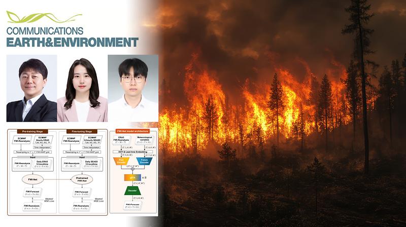
기후변화로 산불의 빈도와 피해가 커지는 가운데, 한 달 뒤 산불 위험을 기존 수치예보 기반 방식보다 더 정확하게 예측하는 인공지능(AI) 기술이 나왔다. UNIST 지구환경도시건설공학과 임정호 교수팀은 전 세계 산불기상지수(FWI)를 하루 단위로 최대 31일 앞서 예측하는 글로벌 딥러닝 모델 ‘FWI-Net’을 개발했다고 25일 밝혔다. 산불기상지수는 기온과 상대습도, 바람, 강수량을 종합해 불씨가 생겼을 때 산불이 크게 번질 위험이 얼마나 큰지를 보여주는 지표다. 이 지수를 예측하면 산불 위험이 커질 지역에 소방 인력과 장비를 미리 배치하고 주민 경보나 산림 출입 통제 같은 예방 대책을 세울 수 있지만, 기존 유럽중기예보센터(ECMWF)의 수치예보 기반 방식은 약 2주가 지나면 지역별 정확도가 빠르게 떨어진다. 반면 연구팀이 개발한 ‘FWI-Net’은 기존 방식보다 31일 전체 예측 기간의 평균 제곱근 오차(RMSE)를 6.6% 줄였으며, 첫 일주일 동안은 오차를 12.4%까지 크게 낮췄다. 또 산불 위험 노출도와 사회경제적 취약성이 모두 높은 지역의 85%에서 산불위험을 실제보다 과소, 과다 평가하는 예측 편향이 줄어든 것으로 나타났다. 특히 산불위험이 ‘매우 높음’인 상황에서 유의미한 예측이 가능한 기간이 기존보다 5일 더 늘어났다. 또 예보와 대응 기반이 부족한 빈곤 지역에서는 3주가 넘는 평균 22일 동안 유의미한 예측 성능을 유지했다. 연구팀은 과거 산불기상지수 변화와 미래 기상 조건을 동시에 반영한 덕분에 이 같은 고성능 모델을 만들 수 있었다. 기온이나 강수량과 같은 미래 기상 상태가 같더라도 앞선 기간의 가뭄과 건조 상태가 누적되면 산불 위험이 커지는 효과를 AI가 학습해 반영한 것이다. 이를 위해 연구팀은 FWI-Net을 두 단계로 학습시켰다. 실제 관측과 기상모델을 결합해 과거 날씨를 복원한 방대한 ERA5 재분석 자료로 먼저 사전학습시켜 중기 예측 성능을 극대화한 뒤, 실제 예보에 쓰이는 SEAS5 자료로 다시 학습시는 방식을 통해 예보자료 부족 문제를 보완했다. SEAS5는 ECMWF가 기온·습도·강수량·풍속 등을 예측해 제공하는 계절 수치예보 자료로, 월 1회만 생산돼 딥러닝 모델을 충분히 학습시키기에 부족하다. 이번 연구는 국민대학교 강유진 교수와 UNIST 지구환경도시건설공학과 이시현 연구원이 제1저자로 참여했다. 연구팀은 “과거의 산불 기상 패턴과 미래의 예측 정보를 AI가 동시에 학습하게 만들어 기존 수치예보 방식의 문제를 보완했다”며, “무엇보다 산불 위험에 크게 노출돼 있으면서도 자체 예측 인프라가 턱없이 부족했던 지역에 신뢰할 만한 예보를 제공할 수 있다는 데 큰 의미가 있다”고 설명했다. 임정호 교수는 “기후변화로 전 세계적인 산불 피해가 급증하는 상황에서 정확한 예측 기술은 실제 국가 재난 대응력과 직결되는 정보 인프라”라며 “개발된 기술은 중기 산불 대응 계획을 세우고, 예보 기반이 부족한 지역의 정보 공백을 줄이는 데 활용될 수 있을 것”이라고 말했다. 이번 연구는 국제 학술지 ‘커뮤니케이션스 어스앤 인바이론먼트(Communications Earth & Environment)’에 지난달 28일 온라인 공개됐으며, 환경부, 산림청, 한국연구재단의 지원을 받아 수행됐다.

원자력공학과, ‘원자력 안전규제라운드테이블’ 개최

연구 2026년 06월 25일 목요일

“도시 열섬, 기후와 도시 형태 함께 봐야만 잡힌다”

도심 열섬은 기후와 도시 형태가 맞물려 나타나는 복합적 산물임이 밝혀졌다. 폭염 대책도 도시별 기후와 도시 형태를 함께 따져 세워야 할 필요성이 제기된다. UNIST 지구환경도시건설공학과 임정호 교수팀은 부산대학교 유철희 교수, 서울대학교, 미국 퍼시픽 노스웨스트 국립연구소(PNNL)와 함께 전 세계 2,213개 도시를 분석해 도시열섬이 기후와 도시 형태의 상호작용으로 달라진다는 사실을 규명했다고 15일 밝혔다. 도시열섬은 도심 온도가 외곽보다 높게 나타나는 현상이다. 건물과 도로, 보도블록 등이 열을 저장하고, 바람 흐름이 바뀌면서 도심에 열기가 쌓이기 때문이다. 연구 결과에 따르면, 열섬 현상의 양상은 도시가 속한 기후대에 따라 달랐다. 한랭 기후 지역의 도시들은 주로 낮 시간에 건물로 인한 열 상승 효과가 두드러졌다. 반면 건조 기후 지역의 도시들은 수분 증발을 통한 대기 냉각 효과가 작고, 건물과 도로가 낮 동안 흡수한 열을 밤에 내보내면서 야간 시간대에 열섬 현상이 강하게 나타났다. 또 같은 기후대 안에서도 도시의 건물 밀도와 높이에 따른 차이가 컸다. 고층 건물이 빽빽하게 모인 도심처럼 열을 저장하기 쉬운 구조가 주변에 많은 지점은 열섬 현상이 강해졌고, 주변에 낮은 건물이 듬성듬성 있을 때는 열섬이 상대적으로 약했다. 연구팀은 전 세계 2,213개 도시를 1km 격자로 나눈 뒤 주변부와 기후 조건이 열섬에 미치는 영향을 인공지능 모델로 계산해 이 같은 분석 결과를 얻었다. 각 격자는 건물 밀도와 높이에 따라 여섯 가지 도시 형태로 나눴으며, 기준이 되는 격자 하나와 이를 둘러싼 8개 격자의 형태를 함께 분석했다. 또 연구팀은 기후변화와 도시 성장 시나리오를 고려한 예측 결과도 내놨다. 기후변화는 열섬 현상을 악화시키는 주요 요인으로 나타났으며, 도시화가 빠르게 진행되는 개발도상국·신흥국 도시에서는 건물 밀도와 높이 같은 도시 형태 변화가 열섬을 키우는 데 더 크게 작용할 것으로 예측됐다. 이번 연구는 UNIST 이시우 연구원과 부산대학교 스마트시티전공 유철희 교수가 공동 제1저자로 참여했다. 연구팀은 “위성 데이터와 인공지능 기계학습 모델링을 융합한 대규모 분석을 통해 도시의 열환경을 기후적 맥락에서 이해해야 한다는 사실을 밝혀낼 수 있었다는 데 의미가 있다”며 “도시열섬 완화 전략 역시 획일적인 방식이 아니라, 각 도시의 기후 조건과 공간 구조에 맞춘 지역 맞춤형 접근이 필요하다”고 말했다. 임정호 교수는 “복잡한 도시열섬 형성 과정을 이해하기 위해서는 대규모 공간자료와 기후자료를 효과적으로 해석할 수 있는 인공지능 기반 분석 기술이 필수적”이라며 “이번 연구 결과는 폭염 대응, 도시 재개발, 열 취약지역 우선 관리 등 다양한 정책 분야에 기여할 것”이라고 말했다. 이번 연구는 과학기술정보통신부 재원으로 한국연구재단의 지원을 받아 수행되었으며, 연구 결과는 세계적 권위의 학술지 네이처 커뮤니케이션즈(Nature Communications)에 5월 11일 공개됐다.

원자력공학과, ‘원자력 안전규제라운드테이블’ 개최

커뮤니티 2026년 06월 23일 화요일

학점 없는 교육은 가능할까? UNIST 조재원 교수, 《구글이 꿈꾸는 대학》 출간

“배워야 할 지식은 줄고 만들어가야 할 지식은 늘었다. 교육은 정답을 찾는 일이 아니라, 세상을 설명할 새로운 방정식을 만드는 일이어야 한다.” UNIST 지구환경도시건설공학과 조재원 교수의 신간 《구글이 꿈꾸는 대학: 학교 토큰이 땡땡땡》(이하 《구꿈대》)이 던지는 교육 개혁의 문제의식이다. AI가 계산하고 거대언어모델(LLM)이 답을 만드는 시대, 조 교수는 학교의 역할을 ‘정답 전달’에서 ‘지식 생성’으로 옮겨야 한다고 제안한다. 조 교수는 과학예술 작가 ‘강하단’이라는 이름으로 23일 《구꿈대》를 출간했다. 2024년 《약자의 결단》, 2025년 《똥본위화폐》 등을 잇는 과학 인문학 저술이다. 전작들이 약자와 화폐, 가치 교환의 문제를 다뤘다면, 이번 책은 디지털 시대 교육과 대학의 존재 이유를 묻는다. 책은 교과서와 교재 중심의 학교교육에 대한 의심에서 출발한다. 기후위기, 저출산, 경제위기처럼 정답이 하나로 정해지지 않는 문제가 늘어나고 있지만 학교는 여전히 정답 맞히기와 점수 경쟁에 익숙하다는 것이다. 조 교수는 이를 제도화된 학교, 표준화된 교육과정, 무한 경쟁 중심의 ‘학교 시즌 1’이라 부른다. 대안은 ‘학교 시즌 2’다. 학생과 교사, AI가 함께 지식을 만드는 교육 생태계다. 학생은 대중 연결망 속에서 배우고 협업한다. 교사는 정답을 전달하는 사람이 아니라 다양한 관점을 열어주는 사람이다. 학생은 그 관점 속에서 현실을 해석하고, 자기만의 문제를 세우며, 사회와 연결되는 지식을 만든다. 책의 핵심 개념은 보이지 않는 ‘큰 귀와 눈’이다. 시험 한 번의 결과가 아니라 학생의 질문과 토론, 실험과 실패, 창의적 시도를 기록하는 디지털 시대의 교육 장치다. 점수와 학점이 학생을 한 줄로 요약한다면, 큰 귀와 눈은 학생이 어떤 문제를 발견했고 어떤 방식으로 해석했는지를 남긴다. 수학 교육에 대한 관점도 이 책의 메시지를 잘 보여준다. 조 교수는 방정식을 푸는 능력보다 현실을 설명하는 방정식을 만드는 능력이 중요해지고 있다고 본다. 경제위기나 기후문제처럼 복잡한 현실의 조건을 읽고 여러 변수를 연결해 자신만의 해법을 설계하는 능력이 미래 교육의 핵심이라는 설명이다. 책 제목 속 ‘학교 토큰’도 같은 맥락이다. 토큰은 학생의 질문, 협업, 실험, 실패, 재해석을 기록하는 교육적 소통의 기호다. 학점이 숫자로 학생을 평가한다면, 학교 토큰은 학생이 어떤 상황에서 어떤 의미를 만들었는지를 보여준다. 조 교수는 AI와 LLM, 블록체인이 결합하면 학점과 학위 중심 교육을 바꿀 새 교육 언어가 만들어질 수 있다고 본다. AI를 교육 현장에서 활용하는 방식도 눈길을 끈다. 조 교수는 인공지능을 디지털 시대 인간의 ‘여섯 번째 감각’이자 ‘함께 배우는 동료’로 읽는다. AI를 잘 쓰는 인재를 길러내는 데서 끝나는 것이 아니라, 학생과 교사, AI가 함께 질문하고 해석하며 지식을 만드는 대학을 그린다. 《구꿈대》가 강조하는 또 하나의 키워드는 ‘놀이’다. 교육 활동이 놀이처럼 이어질 때 변화가 시작된다는 것이다. 학생이 성적을 위해서가 아니라 궁금해서 묻고, 친구와 만들고, 실패하고, 다시 시도할 때 배움은 살아난다. 책은 입학시험과 학점, 학위가 없어도 학생이 지식으로 놀고 연구할 수 있는 대학을 상상한다. 조 교수는 “학교와 교육을 선생님과 학생에게 돌려줘야 한다”고 말한다. 입시 제도 개편이나 표준 교육과정 조정만으로는 교육의 본질을 바꾸기 어렵다는 문제의식이다. 학생이 자신의 장점을 다차원적으로 드러내고, 사회가 그 가능성을 발견할 수 있는 교육 체계가 필요하다는 것이다. 한편 조재원 교수는 UNIST에서 과학인문학과 환경윤리 분야를 가르치고 연구하고 있다. 기후 재앙, 인간 소외, 소득 불균형, 노동가치 등 사회문제를 기호학적으로 해결하고자 연구한 ‘사이언스월든’센터장을 역임했다.

원자력공학과, ‘원자력 안전규제라운드테이블’ 개최

연구 2026년 05월 30일 토요일

이산화탄소보다 84배 강한 메탄, AI로 더 빠르고 정밀하게 탐지한다!

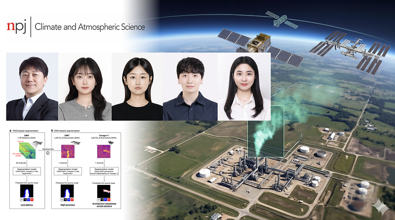
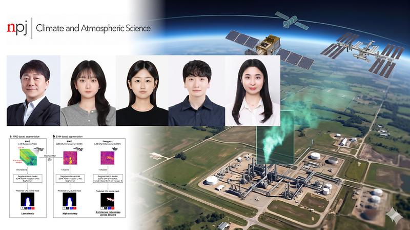
메탄은 배출 뒤 20년 동안은 이산화탄소보다 약 84배 강한 온실효과를 유발한다. 이러한 메탄의 누출을 사람이 일일이 위성영상을 점검하지 않아도 인공지능으로 더 빠르고 정확하게 감시할 수 있는 탐지 기술이 나왔다. UNIST 지구환경도시건설공학과 임정호 교수팀은 초분광 위성 데이터에서 메탄 구름 기둥(플룸)을 자동으로 탐지하는 인공지능 기술을 개발하고, 이를 비교 분석해 감시 목적에 맞는 활용 기준을 제시했다고 25일 밝혔다. 초분광 위성 자료는 지표면에서 반사돼 올라오는 빛을 수십~수백 개의 좁은 파장대로 나눠 관측한 자료다. 연구팀은 NASA 국제우주정거장 관측 초분광 위성 자료인 EMIT 자료를 영상분할 딥러닝 모델에 학습시켜, 위성영상 속에서 메탄 누출 기둥에 해당하는 부분을 자동으로 구분하는 탐지 모델을 만들었다. 메탄은 특정 적외선 파장의 빛을 흡수하기 때문에, 이 파장대의 변화를 보면 메탄이 새어 나와 형성된 기둥을 찾을 수 있다. 개발된 탐지 모델은 세계 여러 지역의 대규모 메탄 배출 사례와 투르크메니스탄, 알제리, 미국 등지의 석유·가스 시설, 폐기물 처리장, 석탄 채굴지 등 다양한 배출원에서 발생한 메탄 기둥을 잘 포착할 수 있었다. 또 설명 가능 인공지능 분석 결과, 탐지 모델은 단순히 영상의 색이나 배경 무늬를 학습한 것이 아니라, 메탄이 빛을 흡수하는 파장대와 누출 기둥의 공간적 형태처럼 실제 메탄의 물리적 특성과 맞는 정보를 활용해 판단하는 것으로 나타났다. 연구팀은 2종류의 데이터를 3종류의 대표적인 영상 분할 딥러닝 모델에 각각 학습시켜 이 같은 자동 탐지 모델을 개발했으며, 각 조합별 탐지 성능도 분석했다. 빛의 세기 데이터인 복사휘도와, 이 데이터를 1차 처리해 메탄 농도 증가 영역을 강화한 자료를 CNN-ASPP, Inception U-Net, SegFormer 모델에 각각 학습시킨 것이다. 각 모델을 비교했을 때 메탄 강화 자료를 학습한 모델들이 전반적으로 더 높은 탐지 정확도를 보였다. 반면 위성이 관측한 복사휘도를 직접 학습한 모델은 정확도는 상대적으로 낮지만, 전처리 과정을 줄일 수 있어 누출 의심 지역을 빠르게 찾아내는 데 유리했다. 또 EMIT 자료에서 확인한 자료·모델 조합을 Tanager-1 자료에도 같은 방식으로 적용해 별도로 학습시켰을 때도 비슷한 탐지 성능을 보였다. 개발된 모델의 확장성을 보여 주는 대목이다. Tanager-1은 민간 위성 기업의 위성을 이용한 초분광 위성자료다. 이번 연구는 양세영·김예진 연구원이 공동 제1저자로 참여했다. 연구팀은 “해상도와 관측 조건이 다른 자료에도 적용할 수 있으며, AI가 어떤 물리적 근거를 바탕으로 메탄을 판별하는지까지 확인할 수 있어 향후 대규모 메탄 누출을 더 빨리 찾아내고 대응하는 차세대 온실가스 감시 기술로 활용될 수 있을 것”이라고 설명했다. 임정호 교수는 “메탄은 어디서 얼마나 새는지를 빠르게 확인하는 것만으로도 감축 효과를 높일 수 있는 온실가스지만, 기존에는 자료 처리와 전문가 검토에 시간이 걸리는 한계가 있었다”며 “이번 연구는 초분광 위성자료와 인공지능을 활용해 누출 의심 지역을 빠르게 선별하고, 필요한 경우 정밀하게 확인할 수 있는 분석 기준을 제시했다는 점에서 국제 사회의 메탄 감축 노력과 배출 검증 체계 강화에 도움이 될 것으로 기대한다”고 말했다. 본 연구는 환경부, 교육부의 지원을 받아 수행되었으며, 연구 결과는 국제 학술지인 npj 기후와 대기과학(npj Climate and Atmospheric Science)에 게재됐다.

원자력공학과, ‘원자력 안전규제라운드테이블’ 개최

연구 2026년 04월 16일 목요일

‘엘니뇨’ 밀리고 ‘남극 진동’ 뜨니 호주 산불 더 극심해졌다 !

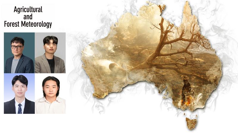
호주 남동부 지역의 산불 위험이 매년 극단적으로 널뛰는 예측 불허 국면에 진입했다는 분석 결과가 나왔다. 변동성이 커진 원인으로는 ‘남극환상모드’라는 대기 순환 패턴의 영향력 강화가 지목됐다. 지구환경도시건설공학과 이명인 교수팀은 1981년부터 2022년까지 호주 남동부 지역의 산불 기상 조건을 분석해 이 같은 사실을 밝혀냈다. 이 교수팀의 연구에 따르면, 호주 남동부의 산불 위험이 2000년대 초반을 기점으로 ‘체제 전환(Regime Shift)’이라 부를 만큼 급격하고 불규칙한 변화를 겪고 있다. 이전 시기(1981~2001년)에 비해 최근 20여 년(2002~2022년) 사이 극심한 산불 발생 위험일(Fire Weather Days)은 약 5배나 급증했으며, 해마다 산불의 강도가 널뛰는 ‘변동성’ 또한 2배 이상 확대됐다. 주목할 점은 산불을 일으키는 ‘지휘자’가 바뀌었다는 것이다. 과거에는 적도 태평양 수온이 변하는 ‘엘니뇨-남방진동(ENSO)’이 호주 산불에 큰 영향을 미쳤으나, 최근에는 남극을 감싸고 도는 대기 순환 패턴인 ‘남극환상모드(SAM)’가 산불 변동성을 결정짓는 가장 강력한 원인으로 부상했다. 이러한 주도권의 변화는 땅과 대기가 서로 영향을 주고받는 ‘지면-대기 결합’이 강화되었기 때문이라는 분석이다. 가뭄으로 인해 지면이 바짝 마르면, 지면이 수분을 어느 정도 머금고 있던 상태보다 태양열이 지표면 온도를 더 급격히 높이고, 이는 다시 대기를 건조하게 만들어 산불이 나기 쉬운 ‘복합 극한 기상(고온, 건조, 가뭄)’을 유도하는 악순환이 깊어진 것이다. 기후 변화는 농업 분야에도 직접적인 타격을 주고 있는 것으로 나타났다. 연구팀은 산불 위험의 변동성이 커질수록 이 지역의 주요 작물인 옥수수 수확량 또한 비례해 크게 변동하는 현상을 확인했다. 기후-산불-농업을 통합한 사회·경제적 재난 관리의 중요성을 보여주는 대목이다. 제1저자인 김기욱 연구원은 “과거에는 산불 예측 시 엘니뇨 현상을 주로 참고했다면, 이제는 남극 지역의 대기 흐름(SAM)과 지면의 건조 상태를 더욱 면밀히 관찰해야 한다”며 “이번 연구는 호주뿐 아니라 기후 변화로 인해 산불이 대형화·일상화되고 있는 전 세계 여러 지역의 산불 예측 성능을 높이는 데 기여할 것”이라고 설명했다. 이명인 교수는 “단순한 기온 상승을 넘어 기상 요인들의 복합적인 상호작용으로 인해 산불의 예측 불가능성이 커지고 있다”며 “강화된 복합 극한 기상 재난의 신호를 기후 모델에 정교하게 반영한다면 미래 기후 재난에 대비한 영향 예보 시스템을 한 단계 고도화할 수 있을 것”이라고 밝혔다. 이번 연구는 UNIST 이명인 교수팀의 주도로 하와이대학교(University of Hawaii), POSTECH 등 국제 공동 연구팀이 참여했으며, 연구 결과는 산림 및 농업 연구 관련 최상위 국제 학술지 ‘농림기상학(Agricultural and Forest Meteorology)’에 4월 11일자로 게재됐다. 연구 수행은 환경부의 ‘신기후체제 대응 환경기술개발’ 사업의 지원을 받아 이뤄졌다.

원자력공학과, ‘원자력 안전규제라운드테이블’ 개최

연구 2026년 04월 13일 월요일

“한국인, 연간 보름은 대기오염 ‘4중고’에 시달린다”

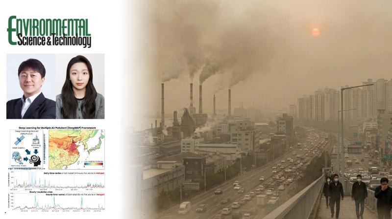
한국인들은 연간 보름가량 세계보건기구(WHO) 권고 기준을 초과하는 미세먼지와 오존 등 4대 대기오염 물질에 동시 노출되는 것으로 나타났다. UNIST 지구환경도시건설공학과 임정호 교수팀은 주요 대기오염 물질 6종의 지표면 농도를 시간단위로 추정해 오염지도를 그리는 인공지능모델인 딥맵을 개발하고, 이 같은 분석 결과를 얻었다고 30일 밝혔다. 연구팀이 이 모델로 2021년부터 2023년까지 동아시아 전역의 대기질을 분석한 결과, 여러 오염물질이 동시에 세계보건기구(WHO) 단기 권고 기준을 초과하는 '공노출' 현상이 광범위하게 발생하고 있었다. 특히 호흡기와 심혈관계 질환을 악화시키는 미세먼지(PM10), 초미세먼지(PM2.5), 이산화질소(NO2), 오존(O3) 등 4개 물질이 한꺼번에 기준치를 초과하는 날이 한국에서만 연간 15일에 달했다. 이러한 대기오염 4중고는 중국 화북평원(24일)과 동부 지역(19일)에서도 두드러졌으며, 주로 겨울철 난방 여파와 봄철 황사, 가을철 고기압 영향으로 오존 생성이 활발한 3월, 4월, 10월에 집중적으로 발생했다. 최근 연구에 따르면, 이러한 복합 노출은 단일 오염물질 노출보다 건강에 더 치명적인 영향을 미칠 수 있어 정밀한 모니터링이 필요하다. 하지만 기존 관측 방식에는 한계가 있었다. 지상 관측소는 산발적으로 흩어져 있어 공간적 공백이 생기고, 위성 관측은 구름에 가려지면 데이터를 얻지 못한다. 대기화학수송모델 역시 해상도가 낮아 지역별 세밀한 변동성을 짚어내기 어려웠으며, 무엇보다 기존 연구 대다수가 오염물질 농도를 하나씩 따로 산출해 실제 복합 오염 상황을 제대로 반영하지 못했다. 반면 분석에 사용된 딥맵은 정지궤도 환경위성(GEMS) 데이터, 대기화학수송모델, 수치모델의 기상자료, 지상관측 자료 등을 통합해 일산화탄소(CO), 이산화황(SO2)을 포함하는 총 6종 대기오염물질의 농도를 시간 단위로 동시에 산출할 수 있다. 공간해상도도 10km로 촘촘해 지역별 오염 분포를 제대로 파악할 수 있으며, 시간 단위 예측으로 오염물질 변화 흐름까지 추적할 수 있다. 제1저자인 강은진 연구원은 “서로 영향을 주고받는 오염물질 간 관계를 함께 학습하는 멀티태스킹 구조를 적용해 기존 단일 오염물질 농도 추정 모델보다 성능이 향상됐다”고 설명했다. 임정호 교수는 “기존에는 대기오염을 개별 물질 중심으로 분석해 실제 환경에서 여러 오염물질이 동시에 작용하는 상황을 충분히 반영하지 못했다”며 “이번 모델은 이러한 한계를 넘어 복합 대기오염을 보다 현실적으로 평가할 수 있게 한 것으로, 향후 대기질 예보와 환경 정책 수립, 공중보건 연구 등 다양한 분야에 활용될 수 있다”고 강조했다. 이번 연구 결과는 환경 분야 저명 학술지인 환경과학과 기술(Environmental Science & Technology)에 3월 20일자로 게재됐다. 연구 수행은 환경부 국립환경과학원, 과학기술정보통신부 한국연구재단의 지원을 받아 이뤄졌다. (끝).

원자력공학과, ‘원자력 안전규제라운드테이블’ 개최

연구 2026년 04월 10일 금요일

“적도 태평양 수온 뒤바뀌면 이듬해 겨울 추위 예측 더 정확해진다”

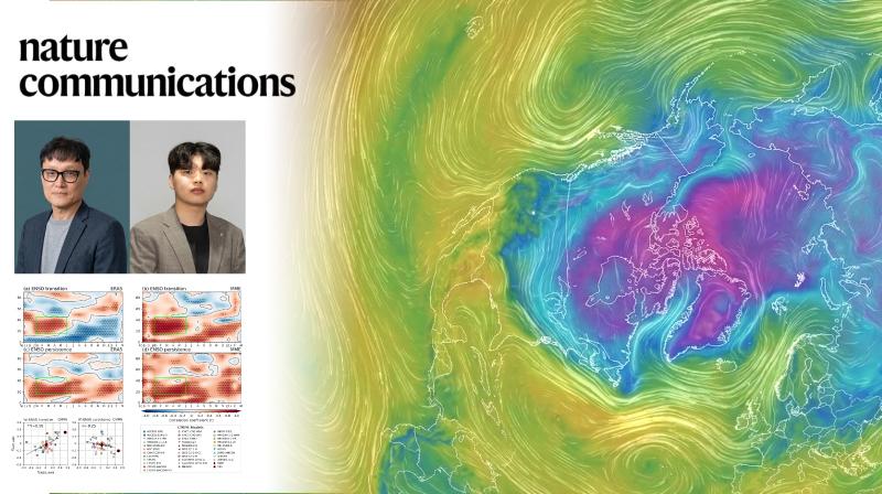
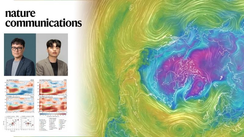
적도 태평양의 해수 온도가 크게 바뀌는 해에는 이듬해 겨울 추위 예측이 더 정확해질 수 있다는 연구 결과가 나왔다. UNIST 지구환경도시건설공학과 이명인 교수팀은 영국 기상청 해들리센터와의 공동 연구를 통해 엘니뇨와 라니냐가 서로 전환되는 시기에 겨울 날씨를 좌우하는 북대서양진동(NAO)의 예측 정확도가 크게 높아지는 현상을 규명했다고 26일 밝혔다. 북대서양진동은 북극의 찬 공기를 가두는 제트기류의 강도를 좌우하는 대기 순환 패턴이다. 북반구 한파와 폭설에 큰 영향을 미치지만 해마다 변동 폭이 커 한 달 뒤 상황조차 예측하기 어렵다. 연구에 따르면, 엘니뇨에서 라니냐로, 또는 라니냐에서 엘니뇨로 바뀌는 해에는 다음 해 겨울 기후 모델의 북대서양진동 예측 성능을 나타내는 상관계수가 0.60까지 높아지는 것으로 나타났다. 반면 엘니뇨나 라니냐 상태가 계속 유지되는 해에는 상관계수가 0.03 수준에 머물렀다. 엘니뇨는 적도 태평양의 해수면 온도가 평년보다 높아지는 현상이고, 라니냐는 반대로 해수면 온도가 낮아지는 현상이다. 연구진은 해수 온도 변화로 시작된 강한 대기 변화가 북쪽으로 서서히 전달되면서 북대서양진동에 영향을 주기 때문에 모델의 예측 정확도가 높아지는 것으로 분석했다. 해수 온도 변화로 유발된 대기 각운동량이 약 1년 뒤 북반구 대기 순환에 영향을 주는 ‘지연 효과’와, 로스비 파동을 통해 대기 신호가 바로 전달되는 ‘동시 효과’가 겹치면서 북대서양진동 패턴이 강화되는 것이다. 로스비 파동은 지구 자전의 영향으로 대기 흐름이 물결처럼 굽이치며 이동하는 현상이다. 제1저자인 김기욱 연구원은 “평소 겨울 대기는 여러 자연 변동이 뒤섞여 있어 신호보다 잡음이 더 큰 상황이지만, 엘니뇨와 라니냐가 서로 뒤바뀌는 시기에는 열대에서 시작된 변화가 신호를 구조적으로 강화하기 때문에 역학적 시그널이 강해져 1년 후 예측 성능을 증가시키는 원리”라고 설명했다. 연구팀이 제시한 이론은 최근 북반구 겨울 기후 사례와도 잘 맞아떨어진다. 재작년 겨울(2024년~2025년)은 직전 해 엘니뇨에서 라니냐로 전환된 시기로, 기후예측 모델들이 북대서양진동(북극진동)을 비교적 정확하게 예측한 사례로 꼽힌다. 반면 지난겨울(2025년~2026년)은 라니냐 상태가 계속 유지되면서 이러한 전환 신호가 나타나지 않았고, 북극 상공 성층권 온난화 등 다른 요인이 작용하면서 한파 예측이 쉽지 않았던 것으로 풀이된다. 이명인 교수는 “적도 태평양에서는 해마다 해수 온도와 대기 순환이 함께 바뀌는 엘니뇨 남방진동(ENSO) 현상이 나타나는데, 이러한 변화가 1년 뒤 북반구 대기 순환으로 이어지는 과정을 역학적으로 규명한 것”이라고 설명했다. 이 교수는 이어 “겨울 기후 변동성을 고려한 장기적 농업 생산이나 에너지 수요 관리 대응 전략과 향후 개발될 한국형 기후예측모델의 정확도를 높이는 데 기여할 수 있을 것”이라고 말했다. 이번 연구 결과는 세계적 권위지 네이처(Nature)의 자매지인 네이처 커뮤니케이션즈(Nature Communications)에 3월 25일(런던 현지 시각) 공개됐다. 연구 수행은 기상청과 국립기상과학원의 ‘기후예측 현업시스템 운영 및 개발’과 ‘기후위기 대응 국가기후예측시스템 개발’ 사업의 지원을 받아 이뤄졌다.

원자력공학과, ‘원자력 안전규제라운드테이블’ 개최

커뮤니티 2026년 03월 02일 월요일

“AI로 원전·교량 이상 징후 포착” 이승준 박사, 교육부장관 표창

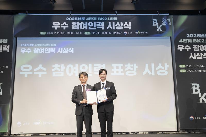
AI와 데이터를 활용해 원전, 교량 등 국가 핵심 인프라의 안전 시스템을 혁신해온 이승준 박사가 지난달 25일, ‘4단계 BK21 사업’ 우수 참여 인력으로 선정돼 교육부장관 표창을 수상했다. 이번 표창은 사고 발생 후 원인을 규명하던 기존의 수동적 대응에서 탈피해, AI로 이상 징후를 선제적으로 감지하고 재난을 예방하는 ‘인프라 안전 지능화’를 선도한 공로를 인정받은 결과다. 지구환경도시건설공학과 신명수 교수 연구실의 이 박사는 2020년부터 BK21 ‘인공지능 중심 건설공학 인재양성팀’의 일원으로 사회기반시설 안전성 평가 연구에 매진해 왔다. 그의 연구는 산업 현장이 직면한 고난도 과제 해결에 초점을 맞췄다. 주행 차량의 하중 특성을 고려한 교량 안전성 평가 모델 개발부터 플랜트 시설 지진 피해 예측, 디지털 트윈 및 비전 AI 기반의 교량 재난 대응 기술 등이 대표적 성과로 꼽힌다. 학술적 역량은 괄목할 만한 수치로 증명됐다. 이 박사는 SCI(E)급 국제 저명 학술지에 총 7편(주저자 6편)의 논문을 게재했으며, 현재 3편의 논문이 추가 심사 단계를 밟고 있다. 국내외 학술대회 발표 실적 또한 29건에 달해 학계의 주목을 받았다. 기술의 실무 적용성도 확보했다. 지진 취약 정보 제공 장치 관련 특허 1건과 소프트웨어 2건을 등록하며 현장 도입 발판을 마련했다. 그는 앞서 2020년 국제 구조건전성 모니터링 대회(IPC-SHM) 3위 입상과 벤틀리 시스템즈(Bentley Systems) 주관 ‘인프라 어워드’ 특별상을 휩쓸며 국제적 경쟁력을 입증했다. 글로벌 협력을 통한 외연 확장도 돋보인다. 일본 교토대와 영국 글래스고대 등 세계 유수 대학과의 교류를 통해 구조 신뢰성 및 재난 위험 평가 분야 선진 기술을 체득했다. 지난 2월 UNIST에서 박사학위를 취득한 그는 현재 한국표준과학연구원(KRISS) 비파괴측정그룹에서 박사후연구원으로 재직하며 연구의 깊이를 더하고 있다. 이승준 박사는 “BK21 사업의 전폭적인 지원 덕분에 연구에만 전념할 수 있었다”며 “기후 위기 시대에 탄소 배출 저감과 인프라 안전이라는 두 마리 토끼를 잡는 연구자로 거듭나겠다”고 포부를 밝혔다. 지도교수인 신명수 학과장은 “검증 절차가 까다로운 원전과 교량 분야에서 AI를 결합한 고난도 연구를 끈기 있게 수행한 결실”이라며 “UNIST의 인프라 안전 기술을 세계 최고 수준으로 고도화하는 데 기여하겠다”고 강조했다.

원자력공학과, ‘원자력 안전규제라운드테이블’ 개최

연구 2026년 01월 22일 목요일

‘100년도 더 가는 난분해성 유해물질’ 과불화화합물 처리 기술 개발

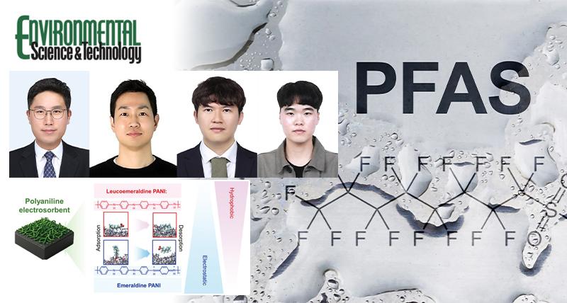
한 번 환경에 유출되면 수백 년간 자연 분해되지 않는 탓에 ‘영구 화학물질’로 불리는 과불화화합물을 처리하는 새로운 기술이 개발됐다. UNIST 지구환경도시건설공학과 김귀용 교수와 반도체소재·부품대학원 김병조 교수팀은 전도성 고분자를 이용해 물속에 저농도로 퍼져 있는 과불화화합물을 흡착 시켜 농축한 뒤 이를 전기 분해하는 기술을 개발했다고 15일 밝혔다. 과불화화합물은 프라이팬 코팅, 방수 의류 제조, 반도체 공정 등에 쓰는 물질로, 자연에서는 거의 분해되지 않는다. 최근 과불화화합물이 극미량만 들어있어도 건강에 영향을 줄 수 있다는 연구가 잇따르면서, 우리나라, 미국 등에서는 음용수에 포함된 과불화화합물의 함량 기준을 리터당 나노그램 수준 이하로까지 강화하고 있는 추세다. 저농도 과불화화합물 폐수까지도 효율적으로 처리할 수 있는 기술 필요성이 대두되는 이유다. 연구팀은 전도성 고분자를 이용해 저농도 폐수에서 과불화화합물을 농축하고 이를 다시 분리해 전기 분해할 수 있는 기술을 개발했다. 전도성 고분자의 성질이 고분자에 걸리는 전압 방향 등에 따라 바뀌는 점에 착안한 기술이다. 이 전도성 고분자가 코팅된 전극을 폐수에 넣고 전압을 가하면, 고분자가 마치 자석이 철가루를 끌어모으듯 과불화화합물을 표면에 모을 수 있다. 전압 방향을 바꾸면 전극에 붙어 있던 과불화화합물이 다시 떨어져 나온다. 이 원리를 이용해 물속에 희석되어 떠다니던 과불화화합물만 선택적으로 골라내어, 고농도로 모은 뒤 따로 처리하면 저농도 상태보다 훨씬 적은 전기에너지로 처리할 수 있게 된다. [연구그림] 전도성 고분자의 전기적 상태 변화에 따른 과불화화합물 흡착 및 탈착 매커니즘 연구팀은 이 방식을 적용해 기존의 전기화학 분해 방식보다 20배 이상 낮은 전기에너지로 과불화화합물을 분해했으며, 하수 처리수, 수돗물과 같은 복잡한 수질 조건에서도 적용될 수 있음을 확인했다. 또 분해조 하나에 과불화화합물을 모으는 흡착 전극과 이를 분해하는 전극이 함께 들어간 정화 시스템까지 만들었다. 분리와 분해가 연속적으로 이뤄질 수 있는 방식이라 과불화화합물 처리 공정을 보다 단순화할 수 있다. 현재 저농도 과불화화합물 폐수는 활성탄 등을 이용해 과불화화합물을 흡착시킨 뒤 이를 고온에서 소각하거나 매립하는, 즉 ‘분리’와 ‘처리’ 단계가 구분된 방식을 통해 주로 처리된다. 특히 매립 처리의 경우, 과불화화합물이 자연계에서 분해되는 것이 아닌 ‘격리’ 수준에 그친다는 문제가 있다. 김귀용 교수는 “전도성 고분자는 일반적인 과불화화합물 흡착제와 달리 탈착 및 재생을 위한 화학약품 처리 등이 필요 없고, 흡착된 과불화화합물을 다시 쉽게 분리해 낼 수 있는 만큼 저농도 과불화화합물 폐수 처리에 경제적인 대안이 될 수 있는 것”이라고 말했다. 또한 “기존 기술들과 달리 분리와 처리 단계를 일원화하고 폐수에서 분리된 과불화화합물을 매립이나 소각하는 것이 아닌 분해까지 할 수 있다는 점도 차별점”이라고 덧붙였다. 연구팀은 분자동역학 시뮬레이션을 통해 전도성 고분자의 과불화화합물 흡착과 탈착 원리도 규명했다. 시뮬레이션 연구를 주도한 김병조 교수는 “이번 계산·시뮬레이션 결과는 향후 오염물 선택성과 가역성을 동시에 갖는 새로운 흡착제를 설계하는 데에도 중요한 기준을 제시할 수 있다”고 설명했다. 이번 연구 성과는 환경·에너지 분야의 권위 있는 국제학술지 환경과학기술(Environmental Science & Technology)에 1월 13일 출판됐다. 연구 수행은 과학기술정보통신부 한국연구재단, 산업통상부 한국산업기술진흥원의 지원을 받아 이뤄졌다.

원자력공학과, ‘원자력 안전규제라운드테이블’ 개최

Research 2026년 10월 02일 금요일

Central Pacific El Niño Improves North Atlantic Winter Forecasts

Abstract The wintertime North Atlantic Oscillation is a major mode of variability affecting climate across the Northern Hemisphere, yet its seasonal prediction skill over the North Atlantic remains lower than that over the Pacific. We examine North Atlantic Oscillation predictability through Pacific teleconnections using reanalysis data and multi-model hindcasts from seasonal-to-decadal forecasting systems. Here we show that Central Pacific El Niño events significantly enhance both North Atlantic Oscillation forecast skill and the predictable signal over the North Atlantic. Reanalysis and equatorial Pacific pacemaker experiments reveal that Central Pacific El Niño enhances sea surface temperature variability over the Aleutian region, modulates Atlantic storm-track activity, and strengthens the Pacific–Atlantic teleconnection. Coupled Model Intercomparison Project Phase 6 simulations suggest that more frequent Central Pacific El Niño occurrence under greenhouse warming may favor this teleconnection. These results identify Central Pacific El Niño-driven Pacific–Atlantic teleconnections as an important source of North Atlantic Oscillation predictability and seasonal forecast skill. Seasonal forecasts for the North Atlantic have long lagged behind those for the Pacific. A new study finds that forecasts of the North Atlantic Oscillation (NAO) become considerably more accurate during winters marked by Central Pacific El Niño. A team, led by Professor Myong-In Lee of the Department of Civil, Urban, Earth, and Environmental Engineering at UNIST traced the improvement to a stronger climate connection between the North Pacific and North Atlantic. The NAO is a major pattern of atmospheric variability that shapes winter weather across Europe and North America. The study involved researchers from the Korea Institute of Science and Technology (KIST) and the Met Office Hadley Center in the United Kingdom. Across several seasonal forecasting systems, the correlation between predicted and observed NAO conditions for January and February was 0.48 over the full study period. During Central Pacific El Niño winters, it rose to 0.78, showing a marked increase in forecast skill. The researchers found that Central Pacific El Niño strengthens a chain of climate interactions linking the two ocean basins. It increases sea surface temperature variability near the Aleutian region of the North Pacific, shifting the position and intensity of the storm track. The resulting changes in atmospheric circulation extend across North America to the North Atlantic, where they influence the NAO. Because ocean temperatures change more slowly than the atmosphere, these North Pacific temperature patterns can persist long enough to provide an early signal of atmospheric conditions that develop later over the North Atlantic. “The North Atlantic has strong internal atmospheric variability, which makes predictable signals difficult for climate models to capture,” said Kiwook Kim, the study's first author. “During Central Pacific El Niño, the stronger connection between the Pacific and Atlantic effectively opens a window of opportunity for more skillful NAO forecasts The findings also shed light on the signal-to-noise paradox, in which the real atmosphere proves more predictable than climate models suggest. The researchers found that models may underestimate the connection between North Pacific sea surface temperatures and North Atlantic circulation, limiting their ability to capture this predictable signa. “Where El Niño develops in the Pacific matters for how its influence reaches the North Atlantic,” said Professor Lee. “If climate models can better capture this connection, we may be able to improve seasonal outlooks for the NAO and related winter extremes, including cold spells and heavy snowfall. The study was published in Communications Earth & Environment , a sister journal to Nature Portfolio journals, on August 27, 2026. The research was supported by the Korea Meteorological Administration and by the Ministry of Science and ICT (MSIT) through the National Research Foundation of Korea (NRF). Journal Reference Kiwook Kim, Myong-In Lee, Daehyun Kang, and Adam A. Scaife, “Central Pacific El Niño-driven Pacific–Atlantic teleconnections are an important source of North Atlantic Oscillation predictability,” Commun. Earth Environment. , (2026).

원자력공학과, ‘원자력 안전규제라운드테이블’ 개최

Research 2026년 10월 01일 목요일

Beyond Ideal Conditions

《Editor's Note: Research works by controlling variables. But the problems it ultimately confronts rarely offer the same courtesy. Heat gets into storage tanks. Expertise shifts from one question to the next. Satellite images arrive out of season. Materials face conditions far beyond the laboratory norm. The obvious response is to restore control —keep the heat out, remove the variation, recreate the ideal test. But what happens when ideal conditions are no longer an option? This month, UNIST researchers took that question in different directions. Some intervene before a problem takes hold —or after a familiar line of defense has failed. Others design for rather variation than uniformity, or put promising results to more demanding tests. The approaches differ, but the underlying shift is the same —rather than trying to restore control, they rethink the solution around what actually changes.》 CHANGE WHERE YOU INTERVENE “Sometimes the best place to solve a problem is not where it appears.” For atomically thin semiconductors, contamination during fabrication can be especially difficult to undo. Plasma exposure changes the chemistry of photoresist, causing residue to bind more strongly to MoS₂. Aggressive cleaning, meanwhile, risks damaging the material itself. Rather than trying to remove the residue afterward, UNIST researchers placed a removable, 5-nanometer metal layer over the semiconductor before patterning, preventing the contamination from reaching its surface. The resulting transistors showed roughly a tenfold reduction in contact resistance and a similar increase in on-current. Liquid hydrogen presents the problem from the opposite direction. Even well-insulated tanks cannot keep heat out indefinitely. Instead of treating insulation as the only line of defense, researchers investigated whether metal-organic frameworks could capture evaporating hydrogen after heat enters the tank and slow the buildup of pressure. In modeling, IRMOF-20 preserved about 97 percent of the volumetric capacity of liquid hydrogen while extending the projected storage period from roughly 64 to 221 days. One solution acts before the problem reaches the material: the other takes effect after a familiar line of defense has been breached. In both cases, changing where researchers intervene changes what can be done about the problem. ■ New Process Shields 2D Semiconductors from Fabrication Residue (Small) ■ Rethinking Liquid Hydrogen Storage with MOFs (Nature Communications) WORK WITH WHAT CHANGES “When the world refuses to stay consistent, the method has to change with it.” Personalization gets harder when expertise refuses to stay fixed. A person who is an expert in one subject may be a novice in another—and even within the same field, expertise can change from question to question. ExPerT responds to that variation rather than smoothing it away. By combining the semantics of each query with patterns in a user's typing behavior, the framework estimates expertise for individual questions and adjusts the detail, terminology, and complexity of its answers accordingly. In a study involving 40 participants and 1,270 queries, it reduced expertise-estimation error by 65.7 percent compared with the strongest baseline. For wildfire assessment, the changing conditions are not the user but the landscape. Satellite images taken before and after a fire may come from different seasons, allowing natural changes in vegetation to be mistaken for fire damage. Instead of requiring seasonally matched images, UNIST researchers use nearby unburned vegetation to estimate seasonal change and correct the comparison. Across 12 US wildfires, it achieved a correlation of 0.72 with field observations using seasonally mismatched imagery—nearly matching the 0.73 obtained with images from similar seasons. One method adapts to knowledge that changes from question to question—the other accounts for landscapes that change with the season. Neither requires the variation to disappear before the analysis can begin. ■ AI Personalization Adapts Answers to What Users Know (ACL '26) ■ Assessing Wildfire Burn Severity Across Seasons (Remote Sens. Environ.) TEST WHAT HOLDS UP “A promising result means more when it holds up under a more demanding test.” Perovskite solar cells (PSCs) have reached impressive efficiencies, but performance under controlled conditions tells only part of the story. UNIST researchers developed a molecular interface that delivered a certified power-conversion efficiency of 26.37 percent, then subjected the cells to repeated swings between −100°C and +100°C. After 16 cycles, they retained about 91 percent of their initial efficiency—putting their stability to a far more demanding test. AI highlight detection faces a different gap between promising results and meaningful tests. Existing benchmarks have largely relied on videos lasting only a few minutes, even though real sports broadcasts can run for hours. SVHighlights closes the gap with 320 videos across eight sports and 640.18 hours of footage. Its videos average about two hours—roughly 30 to 60 times longer than those in existing datasets—allowing AI models to be evaluated under conditions much closer to the task they are meant to perform. One study subjects a material to extreme temperature swings, while the other tests AI against the scale of the task it is meant to perform. Both ask the same question: Does a promising result still hold when the test starts to resemble the challenge it is meant to meet? ■ PSCs Hold Up Under Extreme Temperature Swings (Joule) ■ AI Sports Highlight Detection to a More Realistic Test (ACM KDD '26) Explore the latest issue and follow 『The UNIST Brief』 on LinkedIn to stay updated. Subscribe via LinkedIn

원자력공학과, ‘원자력 안전규제라운드테이블’ 개최

News 2026년 09월 21일 월요일

UNIST Spotlights AI Startups Addressing Regional Challenges

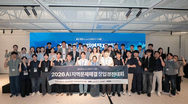
AI startups and aspiring founders from across Korea gathered at UNIST with ideas for applying artificial intelligence to challenges in industry, the environment, and local communities. Hosted by UNIST Startup Incubation Team and Ulsan Metropolitan City, as part of the Ulsan Startup L (Learn) Series, the 2026 AI Regional Challenge Startup Competition drew 56 startup teams nationwide, with 12 advancing to the final round. Finalists presented technologies ranging from predictive diagnostics for industrial piping to AI tools for hospital staff scheduling and administrative tasks and tomato-harvesting robots. Entries were evaluated on technological differentiation and feasibility, growth strategy, and their potential to address regional needs. Everblack Co., Ltd. received the grand prize, the Ulsan Metropolitan City Mayor's Award, while FiberTwin Co., Ltd. received the UNIST President's Award. ProRe Solution and TendyLab received Excellence Awards from UNIST Venture Foundry. The four winning teams will receive tailored support to further develop their technologies and business models. Additional awards provided pathways to investment and international markets. Rika AI and ProRe Solution received the ARISE Award, which access to an investment support program through Pusan National University. FiberTwin received the UFO Award and an opportunity to participate in an international market-entry program in 2027. The event also connected finalists with organizations for consultations on funding and business support. Jeenie Kim, CEO of TIM Solution, an Ulsan-based digital twin and industrial AI company, shared practical lessons from building and sustaining a technology startup. The competition comes shortly after the August launch of UNIST Venture Foundry, which is strengthening the university's technology commercialization and investment activities. UNIST plans to build on partnerships formed through the competition, including Pusan National University, to extend its startup support activities across southeastern Korea. “This competition connects regional challenges with AI technology and entrepreneurship, while helping promising companies grow through collaboration across regions,” said Director Youngsik Kim of UNIST Venture Foundry. “We will continue working closely with partners across Southeastern Korea to support technology startups from commercialization through their next stages of growth.”

원자력공학과, ‘원자력 안전규제라운드테이블’ 개최

Research 2026년 09월 14일 월요일

Satellite Method Improves Wildfire Burn-Severity Assessment Across Seasons

Abstract Change detection-based approaches that use satellite-derived spectral indices (SIs) and their pre- to post-fire differences (dSIs) to quantify burn severity have emerged as powerful alternatives to traditional field-based methods such as the Composite Burn Index (CBI). However, most studies have focused on improving model performance using ideal datasets—those with clearly defined burn areas and cloud-free pre- and post-fire imagery—while overlooking a key limitation: the requirement for phenological consistency between pre- and post-fire imagery. To address this gap, this study presents an Advanced burn Severity Analysis framework using Phenology-detrended indices (ASAP), which produces a refined burn severity index dataset that is robust to seasonal and phenological variability. The ASAP integrates automated delineation of analysis areas based on active fire detections, preparation of pre- and post-fire SI images suitable for vegetation analysis, and a phenology-detrending strategy to align seasonal vegetation conditions between image pairs. The key innovation of the framework is a novel phenology-detrended dSI (pdSI), which uses surrounding unburned areas to seasonally adjust the pre-fire baseline prior to calculating the pre- to post-fire difference, thereby enhancing wildfire-induced signals. Validation using CBI plots and Monitoring Trends in Burn Severity perimeters demonstrates that pdSI consistently matches or outperforms conventional dSIs. These improvements are especially pronounced when pre- and post-fire images are phenologically inconsistent, when phenology-sensitive indices such as differenced normalized difference vegetation index are applied, and in vegetation or climate types with strong seasonal variability, such as deciduous forests and herbaceous areas in temperate climates. Time-series analyzes further show that pdSI mitigates seasonal variability effects, delivering more stable and robust performance compared to conventional dSIs. The proposed framework was also successfully applied to recent large-scale wildfires in the Los Angeles area in 2025, demonstrating its strong applicability and reliability in operational contexts within the wildland–urban interface. Overall, this study provides a simple yet powerful solution to a long-standing challenge in change detection-based burn severity analysis. Satellite imagery is widely used to assess wildfire burn severity, but seasonal changes in vegetation can distort comparisons between pre- and post-fire images. A research team, led by Professor Jungho Im of the Department of Civil, Urban, Earth, and Environmental Engineering at UNIST has developed a framework that corrects for these seasonal differences, allowing a wider range of satellite imagery to be used for post-fire assessment. The framework, called ASAP (Advanced burn Severity Analysis with Phenology-detrended indices), uses nearby unburned vegetation to estimate how seasonal conditions have changed between the pre- and post-fire images. It then adjusts the pre-fire baseline before measuring the change caused by the wildfire. This matters because the spectral indices used to assess vegetation respond to both fire damage and normal seasonal change. If a summer image is compared directly with one taken in autumn, for example, leaf loss or declining vegetation activity may appear as part of the burn signal. ASAP uses comparable unburned areas to account for that background change rather than requiring the two images to be closely matched by season. The resulting phenology-detrended index (pdSI) consistently matched or outperformed conventional difference indices in comparisons with field-based burn-severity measurements. The gains were most apparent when pre- and post-fire images reflected differed seasonal conditions, particularly in vegetation with strong seasonal cycles, such as deciduous forests and herbaceous areas. Across 12 US wildfires, ASAP maintained a correlation of 0.72 with field observations using seasonally mismatched imagery, nearly identical to the 0.73 achieved with imagery from similar seasonal conditions. The framework also automates key parts of the analysis, using active-fire detections to define the area to be assessed and screening imagery for clouds and areas unsuitable for vegetation analysis. This reduces the manual preparation needed before burn severity can be mapped. When applied to five wildfires in the Los Angeles area in January 2025, ASAP reduced the misclassification of unburned areas caused by seasonal vegetation differences and more clearly identified the extent of fire-affected areas. “Conventional satellite-based assessments often depend on finding pre- and post-fire images taken under similar seasonal conditions,” said Professor Im. “By accounting for seasonal vegetation change, we can broaden the range of usable imagery and move toward more consistent, automated burn-severity assessment.” The approach could support faster assessment after large wildfires and provide more timely information for recovery planning and satellite-based disaster monitoring. Taejun Sung and Seyoung Yang served as co-first authors of the study. The research was supported by the Korea Forest Service and the Ministry of Education. The findings were published in the September issue of Remote Sensing of Environment. Journal Reference Taejun Sung, Seyoung Yang, Woohyeok Kim, et al. , “Enhancing satellite-based wildfire monitoring: An advanced framework for burn severity analysis with phenology-detrended indices,” Remote Sens. Environ., (2026).

원자력공학과, ‘원자력 안전규제라운드테이블’ 개최

Research 2026년 09월 07일 월요일

AI Model Maps Seismic Responses Across Nuclear Power Plants

A research team, led by Professor Young-Joo Lee of the Department of Civil, Urban, and Environmental Engineering at UNIST and Senior Research Scientist Jaebeom Lee of the Korea Research Institute of Standards and Science (KRISS) has developed a deep-learning model for post-earthquake assessment of nuclear power plants. The model predicts seismic responses across the structure and estimates which locations may require priority inspection. Post-earthquake assessment can be challenging when sensors are installed at only a limited number of locations. Expanding sensor coverage throughout a nuclear power plant is difficult because of cabling, regulatory, and maintenance constraints. Numerical simulations can fill these gaps, but repeated finite element analyzes become computationally expensive when uncertainties in structural properties are taken into account. The researchers developed a deep-learning surrogate model that combines seismic ground motion with structural parameters to predict acceleration responses at 139 locations. This allows responses to be estimated at locations without physical sensors while reducing the computational cost of conventional analysis. The model also accounts for uncertainty in structural properties. Rather than providing only a binary assessment, it calculates the probability that the response at each location will exceed a predefined equipment-level threshold. These probabilities can help engineers prioritize locations for further inspection. Experimental validation showed an average maximum mean absolute percentage error of 1.37%, with R² values above 0.98. The model generates full acceleration time histories across multiple locations, allowing probabilistic responses to be assessed without repeatedly running computationally intensive finite element simulations. The team also developed a method for configuring the AI architecture according to a structure's natural frequencies. The resulting model achieved accuracy comparable to a deep-learning model with more than 200 times as many parameters, while requiring substantially fewer computational resources. The researchers expect the approach could also be adapted to other facilities that require rapid post-earthquake assessment, including semiconductor plants, data centers, and industrial facilities. “For safety applications, accurate prediction alone is not enough; it is also important to understand the uncertainty in those predictions,” the researchers said. “By quantifying that uncertainty, the framework can provide additional information for experts deciding where further inspection is needed.” The research was conducted jointly by the teams of Senior Research Scientist Jaebeom Lee at KRISS, with Jingoo Lee as first author. The work was supported by the National Research Foundation of Korea and KRISS. The findings have been reported in three papers, including a study published in Reliability Engineering & System Safety. The study was conducted jointly by the UNIST and KRISS research teams, with Jingoo Lee as first author. The work was supported by the National Research Foundation of Korea (NRF) and KRISS. The findings have been reported in three papers, including a study published in Reliability Engineering & System Safety (IF: 13.7). Journal Reference Jingoo Lee, Seungjun Lee, Young-Joo Lee, and Jaebeom Lee, “Predicting seismic floor response for nuclear power plant structures with time-series uncertainty propagation using attention-enhanced multimodal deep learning,” Reliab. Eng. Syst. Saf., (2026).

원자력공학과, ‘원자력 안전규제라운드테이블’ 개최

Research 2026년 07월 08일 수요일

New Deep Learning Model Extends Reliable Wildfire Forecasts Beyond Two Weeks

Abstract The 2025 Los Angeles wildfires highlighted growing risks from climate-driven extremes and the need for reliable wildfire forecasting beyond short lead times. Although the European Center for Medium-Range Weather Forecasts provides global fire weather index forecasts, these products are primarily designed for long-range climate outlooks, and their practical effectiveness remains uncertain in regions with limited local forecasting infrastructure. Here we show that a global deep learning framework, forecasting daily fire weather index values up to 31 days ahead, consistently improves forecast accuracy and reduces bias relative to operational numerical forecasts. The framework learns nonlinear and lagged fire–weather relationships by integrating past fire weather index dynamics and future meteorological conditions. Importantly, forecast bias is reduced in 85% of grid cells where high wildfire exposure coincides with high socioeconomic vulnerability. This demonstrates that data-driven forecasting can help bridge critical information gaps in underserved regions and support more equitable climate risk management. Reliable wildfire forecasts become increasingly difficult beyond the first few weeks, limiting their value for medium-range decision-making. A research team, led by Professor Jungho of the Department of Civil, Urban, Earth, and Environmental Engineering at UNIST, has shown that a global deep learning framework can extend reliable daily wildfire forecasts to 31 days while reducing forecast bias compared with existing operational forecasting systems. Known as FWI-Net, the framework predicts daily values of the Fire Weather Index (FWI), a widely used measure of wildfire danger. Unlike conventional forecasting methods, it combines historical fire-weather conditions with future meteorological forecasts, allowing it to capture the cumulative effects of prolonged heat and drought on future wildfire risk. Across the full 31-day forecasting period, FWI-Net reduced prediction error by 6.6% compared with the operational forecasting system of the European Center for Medium-Range Weather Forecasts (ECMWF). During the first week, prediction error decreased by 12.4%. The model also extended the period of meaningful forecasts under very high wildfire danger by five days. The model performed particularly well in regions where high wildfire exposure coincides with high socioeconomic vulnerability. Forecast bias was reduced across 85% of these areas, and in regions with limited forecasting infrastructure, FWI-Net maintained useful forecasting skill for an average of 22 days. “By combining historical fire-weather conditions with future weather forecasts, the model captures patterns that conventional forecasting systems often miss,” the research team said. “Most importantly, it provides more reliable forecasts for regions facing high wildfire risk despite limited forecasting infrastructure.” “As climate change increases wildfire risk around the world, reliable forecasting is becoming essential for disaster preparedness,” said Professor Im. “We expect this framework to support medium-range wildfire planning while helping reduce information gaps in regions with limited forecasting capacity.” The study was co-led by Professor Yoojin Kang of Kookmin University and Sihyun Lee of UNIST, who served as first authors. The findings were published online in Communications Earth & Environment on June 28, 2026. The research was supported by the Ministry of Environment (ME), the Korea Forest Service, and the National Research Foundation of Korea (NRF). Journal Reference Yoojin Kang, Sihyun Lee, Dongjin Cho, and Jungho Im, "Deep learning-based forecasting provides a pathway to closing wildfire information gaps in underserved regions," Commun. Earth Environment. , (2026).

원자력공학과, ‘원자력 안전규제라운드테이블’ 개최

Research 2026년 07월 01일 수요일

Beyond Algorithms

《Editor's Note: Scientific discovery has always depended on our ability to observe and understand the world. Increasingly, however, many of science's most pressing questions—from interpreting human behavior and dynamic environments to advancing healthcare and understanding Earth's changing climate—have grown too complex for conventional approaches alone. Across disciplines, UNIST researchers are using artificial intelligence to reveal patterns, improve prediction, and open new pathways for discovery. The latest work—from enabling machines to understand human emotion and perceive the physical world to revealing new insights into cities and climate—reflects a broader shift in science: AI is no longer simply a field of research. It is becoming part of how research itself is done.》 From Data to Insight AI is becoming increasingly capable of interpreting the world with greater nuance and context. At UNIST, researchers are advancing AI's ability to understand both people and the physical world through innovations in computer vision and multimodal learning. One research team developed an AI framework that translates emotional cues from speech into realistic facial expressions, enabling more natural human–AI interaction. Another explored how robots can better interpret social touch and express emotions through movement, making human–robot interaction feel more intuitive and lifelike. Researchers also introduced a new camera calibration method that significantly improves how machines perceive dynamic environments. Together, these studies show how AI is moving beyond recognizing data toward interpreting people, interaction, and the physical world. ■ AI Turns Speech into Natural Facial Expressions (CVPR 2026) ■ Making Human-Robot Interaction More Natural (ICRA 2026) ■ AI Advances Event Camera Calibration (CVPR Highlight 2026) From Insight to Discovery AI is emerging as an essential research tool, helping scientists uncover patterns and relationships that would be difficult to detect through conventional methods alone. Rather than replacing scientific expertise, AI is expanding how researchers investigate complex systems across disciplines. At UNIST, researchers developed LightSplat, enabling AI to recognize objects within complex 3D scenes from natural language descriptions in just five seconds. Another team combined deep learning with hyperspectral satellite imagery to detect methane emissions faster and more accurately, improving how researchers monitor one of the world's most potent greenhouse gases. Together, these studies illustrate how AI is accelerating scientific discovery across both digital and environmental systems. ■ AI Recognizes 3D Objects in Five Seconds (CVPR 2026) ■ AI Detects Methane from Space (npj Clim. Atmos. Sci. l Mar. 2026) Across disciplines, AI is becoming more than a field of study. It is emerging as a common language for discovery—expanding not only what researchers can discover, but the questions they are able to ask. Explore the latest issue and follow 『The UNIST Brief』 on LinkedIn to stay updated. Subscribe via LinkedIn

원자력공학과, ‘원자력 안전규제라운드테이블’ 개최

Community 2026년 06월 25일 목요일

New Publication by Professor Jaewon Cho Explores the Future of Higher Education in the Age of AI

“As artificial intelligence (AI) becomes increasingly capable of generating information and answering questions, what should students learn—and what role should universities play?” Those questions are at the center of a new book by Professor Jaewon Cho of Civil, Urban, Earth, and Environmental Engineering at UNIST. Published under his pen name, Kang Hadan, the book—whose Korean title references a future vision of higher education—examines how education might evolve in an era shaped by AI, large language models, and digital technologies. Professor Cho argues that many educational systems remain focused on transmitting established knowledge and rewarding students for finding correct answers. Yet today's learners face challenges—from climate change to economic uncertainty—that rarely come with predetermined solutions. In this environment, he suggests, education must place greater emphasis on inquiry, collaboration, and the creation of new knowledge. The book proposes a future learning ecosystem in which students, teachers, and AI work together to explore questions, test ideas, and develop new ways of understanding the world. Teachers serve less as providers of answers and more as guides who help students navigate different perspectives and connect learning to real-world challenges. A recurring theme throughout the book is the need to look beyond conventional measures of achievement. Professor Cho argues that curiosity, experimentation, collaboration, and creative problem-solving may be just as important as grades and test scores in preparing students for a rapidly changing world. The book also examines how emerging technologies could transform the way learning is documented and recognized. Rather than focusing solely on outcomes, future educational systems may place greater value on the process of learning itself—how students ask questions, develop ideas, respond to setbacks, and build knowledge with others. Another key theme is the role of play in education. Professor Cho suggests that meaningful learning often begins when students pursue questions out of genuine curiosity, collaborate with peers, and experiment without fear of failure. “The amount of knowledge we need to memorize is shrinking, while the amount of knowledge we need to create is growing,” Professor Cho writes. “Education should not be about finding predetermined answers, but about developing new ways to understand the world.” At UNIST, Professor Cho teaches and conducts research in environmental engineering, environmental ethics, and the humanities of science and technology. He previously served as director of the Science Walden, where he led interdisciplinary initiatives addressing issues such as climate change, social inequality, and the future of work.

원자력공학과, ‘원자력 안전규제라운드테이블’ 개최

Research 2026년 06월 22일 월요일

Satellite and Climate Models Help Explain the Variability of Urban Heat Islands Globally

Abstract Urban morphology and background climate are evolving drivers of the urban heat island (UHI) effect, yet the thermal influence of surrounding urban structure and its coupling with climate remain elusive. Here, we show that climate and morphology jointly shape global urban heat. Using a six-class urban typology, long-term climatology, and machine learning, we quantify the thermal influence of surrounding urban structure and project future urban heat across 2,213 cities. We define a city-level thermal impact of the surrounding built environment (TBE) as the area-weighting UHI change induced by specific built-up types. Climatically, cold regions most frequently exhibit high daytime TBE, while arid regions dominate high nighttime TBE. Structurally, a universal pattern persists; high TBE corresponds to denser and taller forms, whereas sparser and lower types dominate low TBE during day and night. Future projections indicate that climate change dominates TBE change in 69% of cities, whereas the Global South exhibits stronger tendencies toward morphology-driven and synergistic intensification than the Global North. Our results highlight the need for locally tailored adaptation strategies that target the dominant drivers—climatic, morphological, or both. Urban Heat Islands (UHIs) are more than just a temperature difference—they emerge from the complex interplay between local climate and how cities are built. Recognizing this connection highlights the need for tailored solutions that address both environmental and structural factors. Professor Jungho Im from the Department of Civil, Urban, Earth, and Environmental Engineering at UNIST, in collaboration with Professor Cheolhee Yoo from the Department of Urban Planning and Engineering at Pusan National Universit (PNU), Seoul National University (SNU), and Pacific Northwest National Laboratory (PNNL) analyzed data from 2,213 cities worldwide. Using satellite imagery, machine learning, and climate models, they revealed that the intensity and patterns of UHIs depend heavily on regional climate and urban morphology. The phenomenon occurs as buildings, roads, and pavement absorb heat, altering airflow and trapping warmth. The study shows that in colder regions, UHIs tend to be most prominent during the day, driven by building heat absorption. In dry climates, the effect shifts to nighttime, when heat stored during the day is released, amplifying nighttime heat. Within the same climate zones, urban density and building height also influence the strength of UHIs: dense, high-rise areas retain more heat, while sparser, lower structures tend to moderate it. Using AI, the researchers divided cities into 1-kilometer grid cells. They analyzed how surrounding urban features and climate conditions contribute to local temperatures. Each cell was categorized into one of six urban types based on building density and height, considering both the immediate area and its surroundings. Looking ahead, the team projected future UHI trends under different climate and development scenarios. Climate change emerges as the main driver, worsening heat in nearly 70% of cities. Meanwhile, rapid urban growth in developing nations is expected to intensify UHIs, especially where dense, tall buildings become more common. Professor Im stresses that understanding urban heat requires integrating large-scale spatial data with AI tools. “Our findings show that effective strategies must be tailored to each city's climate and layout,” he said. “One-size-fits-all solutions don't work. We need approaches that reflect local conditions.” He further added, “Advanced data analysis helps us grasp how cities generate heat. This research will support policies on heatwave response, urban redevelopment, and protecting vulnerable areas.” The study was led by Siwoo Lee from UNIST and Professor Cheolhee Yoo of PNU, as co-first authors. Supported by the Ministry of Science and ICT (MSIT) and the National Research Foundation of Korea (NRF), the work was published in Nature Communications on May 11, 2026. Journal Reference Siwoo Lee, Cheolhee Yoo, Bokyung Son, et al. , “Global patterns of urban heat shaped by climate and morphology,” Nat. Commun. , (2026).

원자력공학과, ‘원자력 안전규제라운드테이블’ 개최

Research 2026년 06월 01일 월요일

AI-Driven Satellite Detects Methane—84 Times More Potent Than CO2—Faster and More Precise

Abstract Methane (CH4) is a dominant driver of near-term warming, yet global emission monitoring remains constrained by slow processing and large uncertainties. Hyperspectral spectrometers enable sensitive detection of CH4 plumes, but the relative advantages of enhancement-based (ENH) and radiance-based (RAD) approaches have not been systematically evaluated. Here we introduce a dual-path deep-learning framework that systematically compares both approaches using globally distributed, expert-validated CH4 plume datasets from EMIT and Tanager-1. The ENH models exhibit higher segmentation accuracy across plume scales, whereas the RAD models, operating directly on 49 shortwave-infrared channels, avoid computationally expensive preprocessing (eg, matched filtering) and enable rapid screening. Both pathways markedly reduce labor-intensive workflows and latency relative to traditional processing while maintaining competitive performance by utilizing deep learning. Explainable AI analyzes demonstrate that the models learn spatial-spectral features consistent with CH4 absorption structure and plume morphology, providing evidence of scientific validity. Cross-sensor evaluation demonstrates architectural robustness across EMIT and Tanager-1, establishing a physics-grounded framework adaptable across hyperspectral sensors. Methane (CH4) is a powerful greenhouse gas—84 times more potent than carbon dioxide over 20 years. Quickly identifying leaks is crucial, but current methods rely on slow, manual analysis of satellite images. Researchers at UNIST have created an AI-based system that automates methane plume detection, making monitoring faster and more precise. Led by Professor Jungho Im from the Department of Civil, Urban, Earth, and Environmental Engineering, the team built a deep learning model to identify methane leaks in satellite imagery. They tested different data types and modeling techniques to determine the most effective approach for global deployment. Hyperspectral satellites capture reflected sunlight across hundreds of narrow wavelengths, revealing detailed surface information. The team trained their models on data from NASA's EMIT satellite, which orbits the International Space Station. The models detect methane by recognizing specific infrared wavelengths absorbed by the gas—clear indicators of leaks. The system successfully identified methane emissions from diverse sources, including oil and gas facilities, waste sites, and coal mines across regions such as Turkmenistan, Algeria, and the US The analysis revealed that the AI system does not merely recognize visual patterns; It interprets physical signals such as absorption features and plume shapes consistent with real-world physics. They tested three deep learning architectures—CNN-ASPP, Inception U-Net, and SegFormer—using two data types: raw radiance and processed data that highlights methane concentration. Models trained on the enhanced data performed better overall. But models trained on raw data responded faster, making them useful for quick scans. Applying these models to Tanager-1 satellite data—commercial hyperspectral imagery—yield similar results, demonstrating the approach's versatility across different sensors. First authors Seyoung Yang and Yejin Kim played key roles in this work. The models work across various resolutions and conditions, relying on physical principles to quickly flag large leaks for further investigation. Professor Im emphasized the importance, “Fast leak detection is essential for reducing methane emissions. Traditional methods are slow and require experts. By combining hyperspectral data with AI, we can identify potential trouble spots in real time and strengthen global monitoring efforts.” Supported by the Ministry of Environment and the Ministry of Education, this research was published in npj Climate and Atmospheric Science on March 25, 2026. Journal Reference Seyoung Yang, Yejin Kim, Minki Choo, et al ., “Beyond localized methane plume detection: a dual-path deep learning framework for sensor-agnostic global hyperspectral methane plume monitoring,” npj Clim. Atmos. Sci., (2026).

원자력공학과, ‘원자력 안전규제라운드테이블’ 개최

Research 2026년 04월 22일 수요일

New Study Uncovers Shift in Climate Drivers Intensifying Wildfires in Australia

Abstract Wildfire variability in Southeastern Australia (SEA) has intensified in recent decades, posing increasing risks to ecosystems and agriculture under a changing climate. However, the mechanisms driving the recent amplification of extreme fire weather remain unclear. Using austral-summer data from 1981–2022, we quantify interannual links between the Forest Fire Danger Index (FFDI) and land–atmosphere variables. Fire Weather Days (FWD) are defined as days exceeding an extreme FFDI threshold each fire season and are validated against satellite-based burned area and fire intensity across SEA. We show that recent fire risk in SEA is characterized not by a gradual increase but by a regime shift in extreme fire weather conditions. An early-2000s transition is marked by enhanced interannual variability and an approximately fivefold increase in FWD, linked to increased positive skewness in daily FFDI. Among FFDI components, the drought factor (DF), representing hydrological stress, exhibits the largest increase in extreme occurrences, especially when co-occurring with high temperature (T) and low relative humidity (RH). The contribution of compound DF & RH & T events to total FWD more than doubles between 1981–2001 (P1) and 2002–2022 (P2). Segmented regression further reveals strengthened interannual FWD sensitivity to DF in P2. In P1, variability reflected atmospheric warming and drying, whereas P2 is characterized by intensified land–atmosphere coupling that amplifies hydrological stress and compound extremes. This transition coincides with changes in large-scale circulation, with the Southern Annular Mode (SAM) emerging as the dominant driver of FWD variability in the recent period, while ENSO exerted a stronger influence earlier. Increased FWD variability is also closely linked to interannual maize yield fluctuations across SEA. These findings highlight a hydrologically-driven regime shift in extreme fire weather and underscore the need for integrated climate-fire-agriculture risk assessment. An international team of researchers, affiliated with UNIST, has identified a dramatic transformation in wildfire patterns across Southeastern Australia (SEA). Analyzing data from 1981 to 2022, the research shows that since the early 2000s, the region has experienced a fivefold increase in extreme fire weather days, driven increasingly by the Southern Annular Mode (SAM) rather than the traditionally dominant El Niño–Southern Oscillation (ENSO). This shift highlights new challenges in predicting and managing wildfires under a changing climate. Led by Professor Myong-In Lee from the Department of Civil, Urban, Earth and Environmental Engineering at UNIST, this study was conducted in collaboration with experts from the University of Hawaii and POSTECH. In this study, the team identified a regime shift beginning in the early 2000s, characterized by emphasized interannual variability and a sharp rise in extreme fire weather days. Over the past two decades, wildfire risk volatility has more than doubled. This change is primarily attributed to the strengthening of land-atmosphere coupling, where drought conditions intensify surface heating, creating a feedback loop that fuels more frequent and severe wildfires. beginning in the early 2000s, marked by heightened interannual variability and a sharp rise in extreme fire weather days. Over the past two decades, wildfire risk volatility has more than doubled. This change is primarily driven by strengthened land–atmosphere coupling: drought conditions dry out surface soils, creating a feedback loop that amplifies surface heating and fosters more frequent and severe wildfires. While ENSO has traditionally been the main climate driver influencing Australian wildfires, recent evidence indicates that the SAM’s influence has grown, now serving as the dominant factor regulating wildfire variability. Kiwook Kim, the main author of the study, comments, “Our findings emphasize the need for enhanced monitoring of atmospheric circulation patterns and soil moisture levels. This knowledge is vital for improving fire risk predictions and informing climate adaptation strategies to safeguard communities and ecosystems.” “Understanding how climate factors influence wildfires is more critical than ever,” says Professor Lee. “Recognizing the increasing role of the Southern Annular Mode and the complex land-atmosphere interactions enables us to develop more accurate prediction models and better prepare for future wildfire seasons.” The findings of this research were published in Agricultural and Forest Meteorology on April 11, 2026. This research was supported by the Korea Environment Industry & Technology Institute (KEITI) under the Climate Change R&D Project for New Climate Regime project, funded by the Ministry of Environment (MOE) of Korea. Journal Reference Kiwook Kim, Myong-In Lee, Seungseok Lee, et al. , “Local and remote drivers of increased variability in extreme wildfire conditions in Southeastern Australia,” Agric. For. Meteorol., (2026).

원자력공학과, ‘원자력 안전규제라운드테이블’ 개최

Research 2026년 04월 10일 금요일

Sea Surface Temperature Shifts in the Pacific Improve Year-Ahead Winter Climate Predictions

Abstract The winter North Atlantic Oscillation (NAO) is a dominant mode of climate variability affecting temperature and precipitation across the Northern Hemisphere, yet its prediction at seasonal-to-decadal (S2D) lead times remains challenging. Here, using multi-year hindcasts from a multi-model ensemble initialized on 1 November for 1962–2019, we show that NAO skill one year ahead improves significantly when the El Niño–Southern Oscillation (ENSO) undergoes a phase transition next year. This improvement is linked to the northward propagation of anomalous atmospheric angular momentum, which dynamically organizes the NAO and is captured in reanalysis and models. During ENSO transition years, prediction skill increases with ensemble size, and when more than 10 members are used, the forecasts display the signal-to-noise paradox. These findings highlight the potential for enhanced one-year NAO predictability when ENSO transitions are present and large ensemble sizes are used in S2D prediction systems, given the skillful prediction of ENSO phase transitions at one-year lead times by multi-model ensembles. A research team, affiliated with UNIST, in collaboration with the UK Met Office Hadley Centre, has identified that major changes in the equatorial Pacific’s sea surface temperatures—such as transitions between El Niño and La Niña—significantly boost the accuracy of winter weather forecasts in the Northern Hemisphere. Led by Professor Myong-In Lee in the Department of Civil, Urban, Earth, and Environmental Engineering, their findings mark a breakthrough in understanding how tropical Pacific variability influences mid-latitude climate prediction. The study reveals that during ENSO transition years, the correlation coefficient for NAO prediction improves markedly—up to 0.60—compared to near-zero correlations in stable ENSO years. This phenomenon occurs because the oceanic temperature changes trigger atmospheric angular momentum shifts that gradually propagate northward, affecting the NAO pattern approximately one year later. The process involves the interaction of delayed effects—initiated by sea surface temperature anomalies—and the rapid transfer of atmospheric signals via Rossby waves, large-scale planetary waves influenced by Earth's rotation. “During ENSO transition years, the tropical ocean changes significantly influence the atmospheric circulation, strengthening the signals used for long-term forecasting,” explained Professor Myong-In Lee. “This understanding can help improve climate prediction models and support strategic planning in sectors like agriculture and energy.” These insights provide a crucial step toward enhancing Korea’s climate prediction capabilities and developing more accurate regional models. By understanding the dynamical mechanisms linking tropical Pacific variability to Northern Hemisphere winter patterns, researchers can improve forecasts for long-term climate variability, aiding disaster preparedness and resource management. This research was supported by the Korea Meteorological Administration and the National Institute of Meteorological Sciences, through projects focused on operational climate prediction systems and climate crisis response strategies. The findings of this research have been published in Nature Communications on March 25, 2026. The study has been supported by the Korea Meteorological Administration (KMA) and the National Institute of Meteorological Sciences (NIMS), through projects focused on operational climate prediction systems and climate crisis response strategies. Journal Reference Kiwook Kim, Myong-In Lee, Adam A. Scaife et al., "ENSO phase transition enables prediction of winter North Atlantic Oscillation one year ahead," Nat. Commun., (2026).

u
  • 등록된 글이 없습니다.

지구환경도시건설과의 다양한 소식
을 전달드립니다.

지구환경도시건설과에서 진행중인
세미나 입니다.